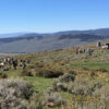


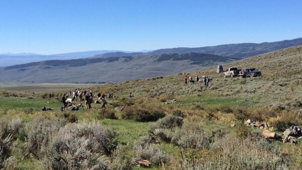


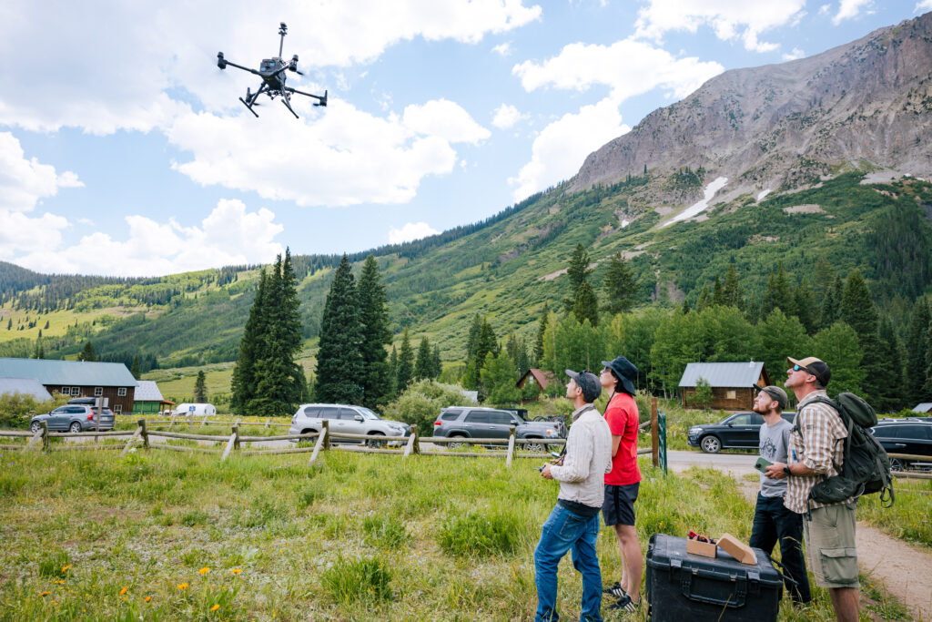
On a vacant lot beside the main road running through Gothic, Colorado, the abandoned 19th-century mining town that’s now home to the Rocky Mountain Biological Laboratory (RMBL), Jayden Omi and Tyler Baker are hoping for a breakthrough.
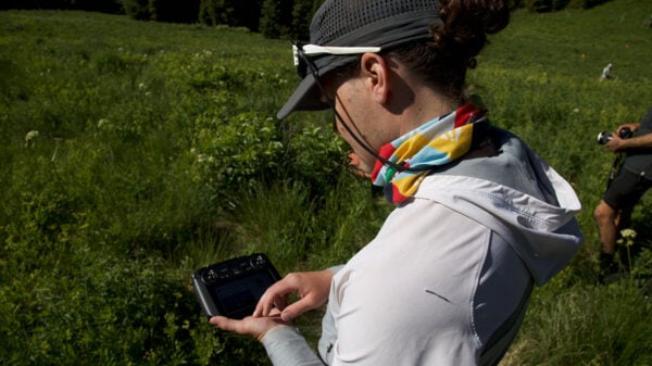
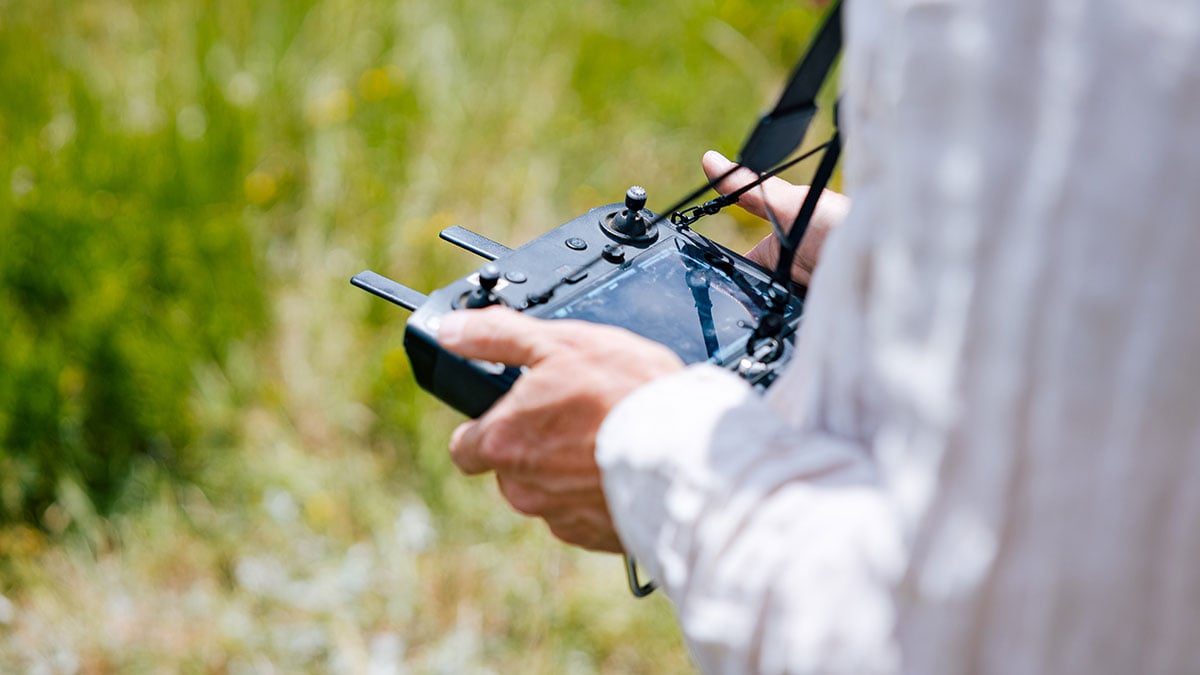
They’ve mounted a cluster of custom-built weather sensors to the bottom of a drone named Bruce, which, thanks to a precision onboard GPS, knows exactly where it is in space, down to the centimeter. One sensor – a sonic anemometer that uses sound waves to measure the speed and direction of the wind – sticks up from the top of the drone like a candle on a cake. Then, with a flick of his thumbs, Jayden sends the drone 20 feet into the air. As data comes in from the sensors, points are graphed on a tablet. But somewhere between the hardware and the software, unwanted ‘noise’ is clouding the data, making it hard to read. And Jayden and Tyler are trying to find the problem.
“We needed to make it so that we’re logging the drone’s position alongside the weather data so that, if we’re collecting data in the sky,” Jayden said, “we know within a couple of centimeters exactly where that measurement was taken.”
The project is part of a larger effort by Dr. Ian Breckheimer, a landscape ecologist and research scientist at RMBL and Western, to understand the journey water takes as it enters and leaves the Gunnison Valley. A drone-based weather sensor can collect detailed data about temperature, humidity, barometric pressure, and wind speed, all while in flight above the forest canopy.
It’s an incredible feat of ingenuity that will eventually contribute meaningful data to the understanding of critical natural processes. But for Jayden, the work is really about seeing what Bruce can do and using ever-evolving drone technology to expand the horizons of what’s possible.
It’s been a journey,” he said. “It’s just been a great opportunity for me to pursue something I like, build a career in it, and simultaneously make Western a better place by bringing more value to students.”
Up and Away
Jayden first saw what drones were capable of midway through his college career when he watched a video of a pilot racing a drone through an abandoned warehouse, navigating tight turns at what seemed like impossible speeds. Before long, he was buying his own racing drone. “The first time you put the goggles on, it feels like you’re flying,” he said. “As long as you don’t get motion sickness, you really do feel like a bird. It was just awesome.
At the time, he was studying computer science, and it felt like a good direction to take his career. “I’m still in front of a computer a lot,” he said, “but I still get to do hands-on stuff, build things like drone attachments, fly drones, and tinker with things.”

After graduating with a degree in Computer Science in 2023, Jayden accepted a post-baccalaureate research role at Western, where he works alongside Tyler, a mechanical engineer, helping guide students through a variety of technical projects, all while helping to develop the University’s first drone lab in the Rady School of Computer Science and Engineering.
But as he started to push one part of Western’s drone program forward and consider his own future in the field, he found himself learning the necessary rules and regulations and carefully following the letter of the law. Sometimes, he sought counsel from someone just across campus who’d already spent several years learning all the ups and downs of drone flight and dreaming about all the promise they held.
Dr. Crossley learns to fly
Dr. Phil Crossley is the Chair of Western’s Behavioral and Social Sciences Department, a geography professor, and, until 2018, a novice when it came to drones. It was just a few years after modern mass-market drones became widely available, and a project involving the use of drones for Search and Rescue came across his desk. He could see that the possibilities were expansive, and immediately saw the potential to use drones to study geography.
In the fall of that year, he bought the geography department its first drone and started learning the ropes. Soon, he was helping students interested in incorporating drone mapping into their research. Word of the new tool quickly spread around campus, and new opportunities to collaborate started coming in. He worked with several graduate students in the Master of Environmental Management and MS Ecology programs to map research sites as part of long-term monitoring projects. He traveled with his colleague, Western anthropologist Dr. David Hyde, to remote northwestern Belize for an aerial survey of the Medicine Trail archeological site, an ancient Maya ruin.
Western’s marketing department worked with Crossley to capture aerial photos of campus during different seasons, and filmmaker Renea Roberts collaborated with him to film study sites for her documentary, Thinking like Water. “We developed a great system where I fly the drone, and she calls the shots from a connected tablet. By flying the drone, I enable the filmmaker to think about the image instead of thinking about flying. They’re just thinking about the video,” he said. “That was a surprise to me because I hadn’t thought of myself as participating in filmmaking.”
When another colleague, geology professor Dr. Ryan King, asked Dr. Crossley for help documenting a hard-to-access site of fossilized burrows made by an unidentified Mesozoic-era animal, Crossley was happy to help. He outfitted a drone with a camera and surveyed the site, providing photographs from different angles that could be stitched together to make a three-dimensional image, a process known as photogrammetry. Preliminary findings suggest the burrows might have been made by some of the area’s earliest mammalian inhabitants.
The opportunities to use drones in research seemed boundless. But for all the innovation, challenges remained. One of the problems with incorporating the new technology into the classroom was that its advancement had started to outpace regulations meant to ensure people operate drones safely. Because Western is in such close proximity to the Gunnison-Crested Butte Regional Airport, the FAA also prohibits drone flights on campus without an often lengthy bureaucratic approval process.
To address the challenges, Dr. Crossley started an Unmanned Aerial Vehicle (UAV) Imagery Acquisition course where students learn not only to fly drones but to plan missions, manage risks, and navigate the FAA’s complex rules. He also worked with the FAA to designate Western’s 300-acre Coldharbour Ranch, east of town, as a federally recognized drone flying area. “It gives students a place to learn how to fly legally and safely,” he said.
The future is looking up
Dr. Crossley and Jayden both see drone technology as an important part of Western’s future. While Crossley continues pushing to make drones more accessible to students and integrate them into more disciplines, Omi represents the next generation: an alumnus who turned his passion into a profession and who now provides a model for students of what’s possible when they follow their curiosity.
Despite being around for more than a decade, mass-market drones still feel new and look unique enough to remind us that the future has arrived. That novelty has created interest on campus where it was once hard to find. Western’s Geography and Geospatial Analysis program, offered only as a minor, hasn’t always generated a lot of interest from young students at career fairs, despite the potential to apply it to a number of fields, from ecology to criminology. Then, Dr. Crossley established a Geographic Information Systems (GIS) certificate program three years ago and started bringing his drones to recruiting events. “No one ever talked to me in 18 years. But when I went there representing the GIS certificate with drones on the table, I had lines of people waiting to talk to me,” he said. “It’s clearly of interest to prospective students.”
For Omi, drones were an interest that has seamlessly turned into a career. Today, he helps operate Western’s drone lab in the Rady School of Computer Science and Engineering, mentoring undergraduates and supporting their projects. But he also sees himself looking to the horizon, with a number of possible paths to take, whether they lead toward logistics, entertainment, or even defense. And while the task needs to be interesting to keep Omi’s attention, like building a drone-based weather station, the tool is really the reason he’s there.
Back in Gothic, where Bruce takes the weather station into the air, the data isn’t perfect yet, but it’s getting better. For Omi, that’s the essence of the work: test, refine, and try again. Only a few people have been successful in what they’re trying to do, and those people aren’t telling their secrets. What they learned is proprietary and valuable. And what Western researchers are learning about drones is proving to be valuable, too.
“Drones have given me a career and a way to contribute to my community. And we’re only just starting to see what’s possible,” Omi said. “I just love drones.”