For generations, people have come to the Yampa looking for something. On a weeklong journey through Dinosaur National Monument, Western students discovered what the river has to give
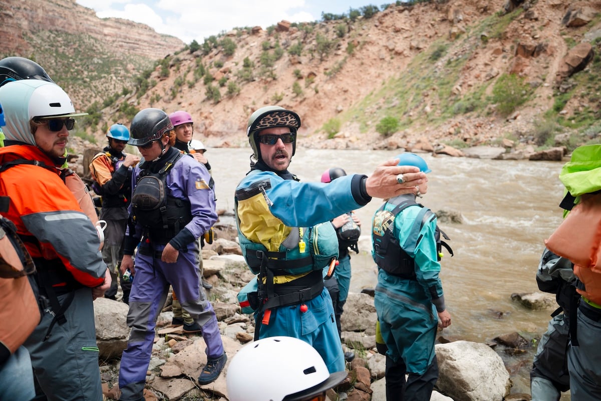
A few minutes ago, Carter “Catfish” Freericks (‘15) was standing on a sandbar, teaching a wide circle of lifejacket-clad college students about expedition mindset, Leave No Trace, and river safety, all in a pitch that pierced the cool high-desert air like a javelin. Now, sitting between the oars of his raft, he’s near a whisper.
We’d just floated past the point where the Yampa River leaves Deerlodge Park, a wide floodplain in a broad valley of low, juniper-dotted hills, and squeezed between towering gray and gold sandstone cliffs. It’s a canyon relatively few people will ever see, but at least it’s still here. Like many river canyons in mid-20th-century America, this one was slated to be dammed so the resulting reservoir could generate electricity and water crops across an arid and growing Southwest. Then, a group of conservationists, convinced the canyon’s value lay beyond its capacity to hold water, stepped in to stop it.
Into the Canyon
Here, close to where Colorado, Utah, and Wyoming meet, the Yampa River drains a nearly 8,000-square-mile piece of northwestern Colorado as it tumbles 250 miles from its headwaters near Steamboat Springs to its confluence with the Green River, 47 miles further downstream. From there, the Green flows mostly south to the Colorado River near Moab. These 72 miles of the Yampa and Green rivers through Dinosaur National Monument are some of the most remote.
But it’s familiar territory for Dr. Mark “Gibby” Gibson, a professor of Recreation and Outdoor Education at Western, who has been in love with rushing water since he left the Midwest as a teenager and stopped counting his trips down the Yampa years ago.
Gibby started running the Yampa River professionally in 1990, when he first approached the owner of the rafting company Adrift about a job shooting video of raft trips from his kayak. Soon, he was rowing big, inflatable rafts of paying clients through the canyon’s Class III and IV whitewater. He’s had a relationship with the canyon and the company ever since.
Gibby’s experience on the Yampa is rare, even among dedicated river runners, who can wait years, even decades, to get a permit to float through the canyon. After taking a teaching position at Western in 2000, Gibby started organizing trips with students and eventually added the Water-based Yampa River Expedition to the course offerings. It didn’t take long for some of those students who took his class to start guiding for Adrift themselves.
Catfish, our trip leader, is a Western alum who took his first trip down the Yampa as one of Gibby’s students more than a decade ago. It was the same for Annie and Hayden, both guides for Adrift, who helped our group with logistics. Gibby’s son, Finn, who is also a guide on the trip, started running rivers at 13 and is now about to graduate from Western. And when Catfish asked this group of students if anyone saw a future as a whitewater guide, at least a couple of hands went up.
Before the River
Before they could learn how to run the Yampa’s whitewater, Gibby wanted them to understand its significance.
A few days earlier, not many of these students, really knew what it took to get a multiday river trip underway. As ROE students, they all had some level of backcountry experience, and they’d all been car camping. Very few, however, had ever floated their car-camping gear into the backcountry. This trip was an opportunity to see the life of a river guide firsthand.
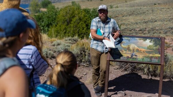
After spending a night at Split Mountain Campground, the group stopped at Dinosaur National Monument’s fossil quarry, where a modern steel-and-glass building encloses a steep rock wall four stories high and nearly half as long as a football field, crowded with more than 1,500 dinosaur bones. About 150 million years ago, the sandstone was part of a river system that crossed a broad floodplain, where dinosaur remains settled before being sealed away in sediment.
After leaving the fossil quarry, Gibby had the students spend the rest of the day giving back to the people supporting their river trip, either helping with maintenance at Adrift’s headquarters or working on the small farm that supplies many of the vegetables for the company’s multiday trips.
The next day is pack day, and anticipation is high. Until now, the class has covered history and planning. Today is about execution, and the guides lead them through a well-rehearsed routine. Teams are established. Lists are made. Boats get organized, and piles of gear from the warehouse are assembled. Everything gets packed into dry bags, dry boxes, and sealed ammo cans. They spend more than $1,200 on food at a local grocery store and buy lunch at a local pizza shop in Jensen. Then they pack everything onto trailers or into vehicles and drive to Deerlodge Park.
Reading the Water
The first section of the Yampa we encounter that’s rough enough to have earned a name is a Class III called Teepee, and the group pulls into a narrow eddy among the rocks upstream to take a look.
The water level in the river this year is near historic lows, at around 2,000 cubic feet per second (CFS), or nearly one-tenth of the flow in a year with a big spring runoff. The low water creates its own unique set of challenges. Instead of big, rollicking whitewater, where a rock might mean a wave to play in, this year, it’s just a rock.
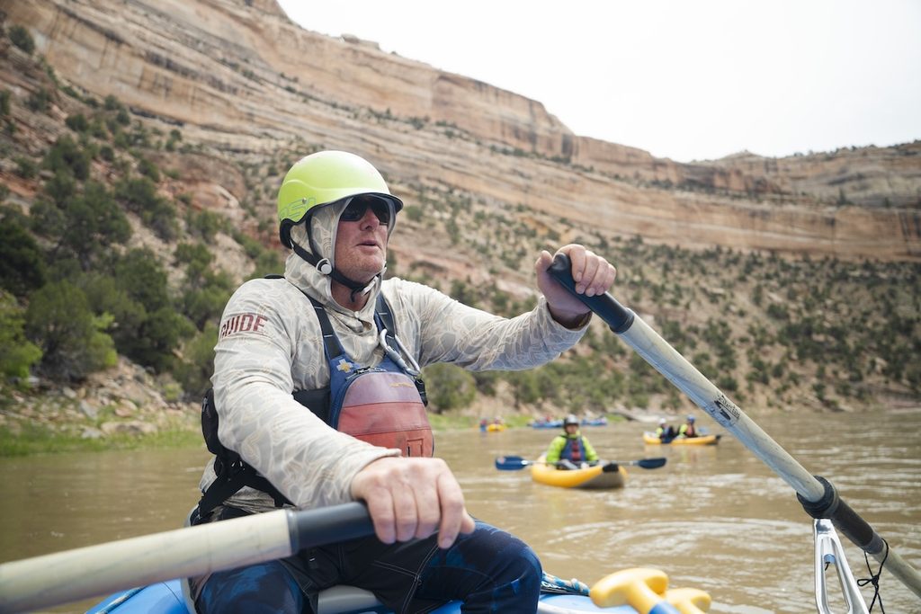
Although it may seem that the river does most of the moving on a whitewater trip, the amount of work each guide does to get a nearly 4,000-pound raft downstream is relentless. All day, they lean into or pull against the oars, maneuvering between exposed rocks and other hazards or pushing through the slower sections of the canyon.
Day One on the river covered 23 miles before we pulled into Big Joe, a campsite just upstream from a Class III rapid of the same name. But reaching camp only started another round of work for the guides. Soon after securing the boats, someone yelled “fire line,” and the guides started unstrapping all of the gear as students fell into single file to unload each boat, one bag or box at a time, like a bucket brigade.
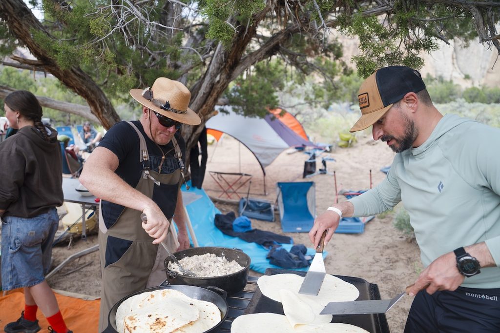
Then, ashore, each of them joined their team to take on a revolving set of camp chores in the kitchen, the dish station, camp, or the groover – a stainless-steel tank topped with a sealing lid and a white toilet seat that’s set somewhere away from camp with a nice view of the canyon. In the morning, the whole routine would start again in reverse with a predawn call for coffee.
Big Joe
Unlike yesterday, Day Two will be short, calling for just three miles of river travel before we pull over to camp at our next assigned site downstream. So there are some non-rafting activities planned around both camps today.
Ten years ago, Catfish heard someone say there were pools of water high in the cliffs above Big Joe, at the mouth of a crescent-shaped side canyon. The next morning, everyone scrambled up loose scree to find out if the story was true.
Even with relatively low flows, the water in Big Joe is too fast and powerful for the students to swim. But one by one, the guides jump into the current and hold their hands up to demonstrate how a swimmer in distress should call for a rescue bag full of rope thrown from shore.
Downstream, students listened as the guides walked them through the steps, then took turns in the controlled chaos of whitewater training, memorizing the positions, practicing the moves, throwing the rope to a struggling swimmer, and coiling it again for the next throw. Each step an opportunity to teach an important lesson.
And the lessons weren’t just about whitewater.
Reading the Walls
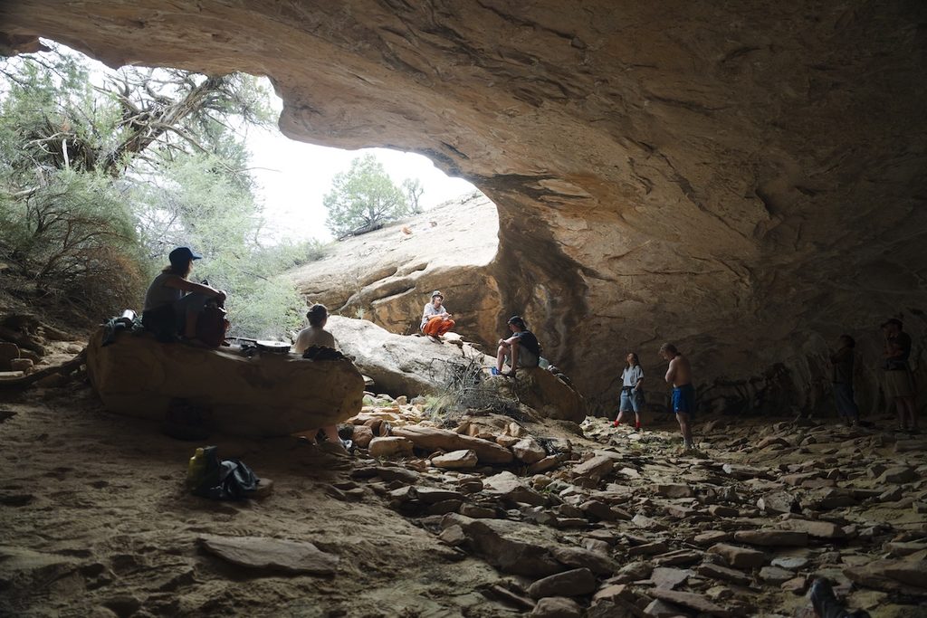
Downstream, Harding Hole sits on a high, wide sandy shelf at the mouth of a side canyon that cuts past a sheer, sandstone face hundreds of feet high. The students set up camp in spitting rain before setting off on a short hike along the canyon wall to Spiral Cave, shaped like a ram’s horn and open in the center.
To the uninitiated, the geology in a place like the Yampa Canyon is impressive, but the timescale it speaks to is almost too big to comprehend, like trying to understand the size of the universe by looking at the stars. Some of the rocks exposed within Dinosaur National Monument record events stretching back billions of years, and many of its layers are visible only because the Yampa and Green rivers have spent millions of years cutting into them.
In some places, the rocks are as sharp and angular as cinder blocks. Elsewhere, they look like smushed marshmallows or stacks of pancakes. Their character can change around a bend, sometimes even from one side of the canyon to the other. Once you learn how to read them, the canyon walls become more than scenery. They tell a story.
But the fossils and rocks aren’t the only record of the canyon’s past.
Making a Mark
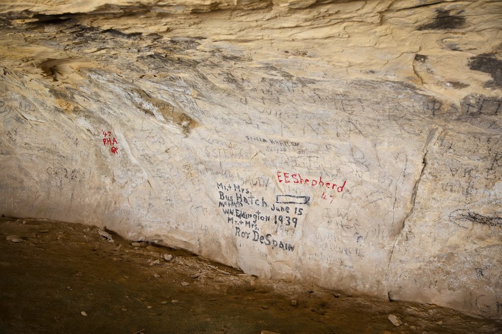
Signature Cave sits on the inside of a sweeping bend in the river, carved like an open mouth into a rock ledge above the canyon floor. Inside, travelers have been making their marks for generations. Names and dates, mostly written in charcoal, cover the sandstone, and sometimes the much older pictographs left by people who passed through the canyon long before them.
Archaeological evidence records at least 10,000 years of human habitation in and around the canyon, from Fremont farmers to Spanish expeditions, trappers, and homesteaders. Butch Cassidy and the Wild Bunch had hideouts near here.
One of the cave’s most prominent signatures came from Bus Hatch, a Vernal, Utah, river runner who navigated the Yampa and Green with his wife, Eva, in 1935, helping open the canyon to a new type of use. Like those before them, they arrived with their own ideas about what the canyon was for and who had the right to decide, a question that still resonates today.
On our way back to the boats after leaving Signature Cave, we passed a group of rafters we’d been staying just ahead of since Deerlodge Park. When their leader recognized Gibby, he stopped us to introduce him to the group.
Nearly two decades ago, Gibby helped students in one of his classes organize the Yampa River Awareness Project, which they developed to remind people of the pressure on the Yampa. They assembled a group of a dozen professionals who approached the river from different perspectives and took them down the river as a reminder of all the reasons the Yampa deserved continued vigilance. This group in front of us was a direct descendant of that effort, now carried on by Friends of the Yampa, 19 years later.
Failing to see the canyon’s value could cost its freedom and almost did once before.
What’s a river worth?
Not long after Bus Hatch made his historic run through the Yampa Canyon, the federal government started asking a similar question.
In the 1940s, the U.S. Bureau of Reclamation proposed the Colorado River Storage Project, including a 529-foot dam at Echo Park and a smaller dam at Split Mountain. The reservoirs would have flooded much of both canyons, despite Echo Park’s location inside Dinosaur National Monument.
The National Park Service opposed the plan, and Bus Hatch began taking supporters and opponents down the river to see what was at stake. Conservationists nationwide joined the fight, which ultimately came down to competing visions: a West built around water and power, or a wild river and canyon full of history and wonder that, once lost, could never be replaced.
The Colorado River Storage Project became law without the Echo Park dam, which was instead replaced by a dam farther upstream at Flaming Gorge. The victory helped shape the modern conservation movement and build support for the Wilderness Act and Wild and Scenic Rivers Act.
But in dry years like this one, even generations later, you can still hear the argument for a dam echo through the canyon.
“Save The Yampa”
The rain had been slowly building since Harding Hole and seemed to reach a crescendo sometime during the night at the Box Elder campsite. In the morning, the rain had mostly lifted, and low gray clouds drifted through the upper reaches of the canyon. Waterfalls poured over clefts and depressions in the rock shelves further down. Catfish said it was only the second time he’d ever seen snow dust the canyon rim in May.
With camp packed, the group gathered by the river to reflect on what might have been here had people invested in the place not spoken up to save it. Finn read a poem his father had written (see sidebar), and the guides told the group they’d be starting the day’s float with five minutes of silence. Then we pushed off.
There were no questions. No banter. No jokes. No lessons. Just the sound of oar blades dipping in the water, the tumbling call of a canyon wren, and the hiss and splatter of falling water.
Until then, our little armada had been just the latest in a long line of people going to the canyon to find something: water, fur, escape, enjoyment. And we’d failed to see that the canyon’s value lay outside anything we might find there. After several days of nearly constant chatter, the silence seemed to give the canyon a chance to speak for itself.
Downstream, the boats pulled over just upstream of Echo Park, near the place where the dam would have stood. Catfish asked everyone to breathe in deep and reflect, thinking of someone who isn’t here anymore. The image of loss was powerful, and sniffles spread through the group. Then, in unison, everyone screamed “SAVE THE YAMPA!” and listened to the words reverberate down the canyon and deep inside.
Against the scale of the canyon around us, we’d be here only slightly longer than those echoes. But in less time than that, everything we’d seen could have been lost. That it wasn’t lost seemed to place a solemn responsibility on the students, as among the river runners who’d seen it, to protect the river and its canyon for the future.
The boats pushed off toward Echo Park, where the warm, brown, sediment-rich Yampa disappeared into the cool waters of the Green beneath Steamboat Rock. From that point on, we were no longer floating the Yampa, but we were all carrying something from it.